

Greece Deploys Thermal Satellite Network to Spot Early-Stage Wildfires
A four-satellite constellation detects heat through smoke to spot fires as small as 16 square meters.
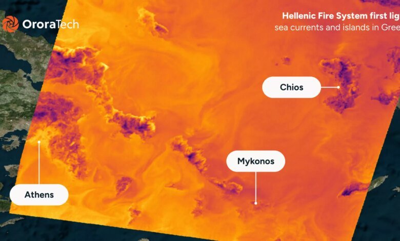
Greece has deployed a dedicated constellation of thermal-imaging satellites to spot emerging wildfires as small as 16 square meters through heavy smoke, rushing the space-based network into service across Attica and popular tourist islands as emergency crews confront summer blazes.
The system, known as the Hellenic Fire System, began downlinking thermal imagery in June and is scheduled to reach full operational capability in September. Developed by German space startup OroraTech in partnership with the Hellenic Space Centre, the network uses four small satellites operating in low Earth orbit to deliver rapid thermal detection and fire-spread predictions directly to ground authorities.
Unlike conventional optical sensors that are blinded by smoke plumes, the constellation carries thermal infrared instruments capable of identifying heat signatures down to 4 by 4 meters. The spacecraft perform initial data analysis in orbit, screening out false alarms before transmitting prioritized fire alerts.
“It doesn’t just take pictures,” said Ioannis Lantouris, head of Greek operations at OroraTech. “We process the pictures on the satellite and then send them down to Earth. It changes the whole way we perceive and manage wildfires. You don’t need a human to call the fire department first. And when you do detect the signs, you can analyze them faster.”
By combining terrain mapping with onboard thermal readings, the software projects how a detected fire is likely to spread before initial response crews arrive on scene.
Traditional satellite wildfire monitoring has relied primarily on high-altitude environmental platforms designed for general Earth observation. Those systems force emergency planners to choose between high-resolution imaging and frequent orbital revisits, often failing to detect small fires until they expand significantly.
The Greek network addresses that constraint by spacing identical small satellites along coordinated orbital planes, providing frequent coverage windows over high-risk Mediterranean terrain.
“As Greece passes out of the view of one satellite, it comes into the view of the next in the constellation,” said Thomas Smith, associate professor of environmental geography at the London School of Economics.
Dimitris Bilziotis, Earth Observation program manager at the Hellenic Space Centre, said the ability to program timing and target high-risk zones on demand gives Greek authorities unprecedented operational control during peak fire conditions.
However, operationalizing the technology inside emergency command centers presents immediate practical hurdles as commanders adapt to machine-driven alerts.
“We’ve come up with a solution, but now the most difficult part is the adoption of that solution,” Bilziotis said. “The fire brigade is used to the technology they were using before, so now we have to train them on how to process the new kinds of data.”
The Greek constellation scales up thermal technology previously proven on OroraTech’s global eight-satellite deployment launched last year, tailoring orbital timing and detection algorithms to Greece’s fractured geography and island chains.