
Android Location Accuracy Fixes: Settings, Calibration, and When to Move
Settings, calibration tricks, and hardware differences that determine whether your blue dot is precise or a guess
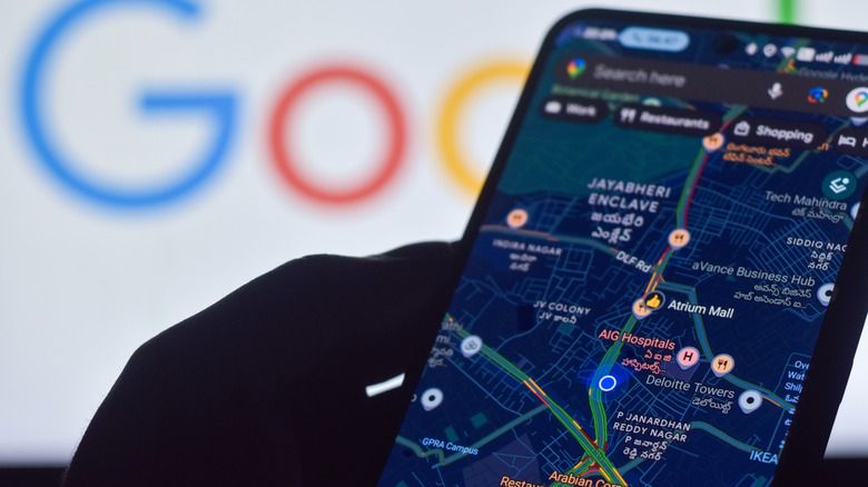
Your Android phone says you’re three blocks from where you actually stand. The blue dot in Google Maps pulses with a wide, translucent halo — the universal symbol for “we’re guessing.” For anyone relying on turn-by-turn navigation, sharing a live location with family, or trying to find a parked car in a sprawling lot, that uncertainty ranges from annoying to unsafe.
The fix usually starts in Settings, not the map app. Android’s Location Accuracy service — renamed from Google Location Services in recent versions — acts as the master switch for fusing GPS, Wi-Fi, cellular, and sensor data into a single position estimate. On Android 12 and newer, the path is Settings > Location > Location Services > Location Accuracy. On Android 11 and older, look under Settings > Location > Advanced > Location Accuracy. Toggle it on and the phone begins crowdsourcing anonymized wireless signal strengths from nearby devices, the same principle that powers Waze traffic alerts and Apple’s Find My network for AirTags.
With the service off, the phone falls back to raw GPS and onboard sensors — accelerometer, gyroscope, barometer. That works fine in open sky. In a downtown canyon of glass and steel, or inside a shopping mall where satellite signals don’t penetrate, GPS alone can drift by 50 meters or more. Wi-Fi and cellular triangulation shrink that error radius dramatically, often to under 10 meters. The trade-off: Google collects anonymized signal snapshots to refine its global location database. Users uncomfortable with that transmission can leave the toggle off, but they sacrifice indoor and urban accuracy.


App-level permissions matter just as much. Even with system-wide accuracy enabled, individual apps must be granted “Precise location” access (Android 12+) or “Allow all the time” (older versions). Navigate to Settings > Location > App location permissions and verify that Maps, your rideshare app, and any safety or family-sharing tools have the highest tier. A common oversight: battery-saver modes or third-party cleaner apps silently revoke background location access for “infrequently used” apps, breaking live-sharing features without warning.
When the blue dot still wobbles, Google Maps offers two built-in calibration tools. The newer Lens in Maps (formerly Live View) uses the camera to match street-level imagery against Google’s Street View database, locking your position to centimeter-level precision near recognized landmarks. Point the camera at a storefront or intersection, tap the Lens icon, and the app aligns your dot instantly. For devices without ARCore support or in areas lacking Street View coverage, the legacy compass calibration remains: open Maps, tap the blue dot, select “Calibrate,” and trace a figure-eight in the air until the beam narrows. Both methods reset the magnetometer and sensor fusion algorithms that track heading.
Connectivity is the silent prerequisite. Airplane mode, a dead mobile data plan, or a Wi-Fi network with no internet backhaul all prevent the phone from downloading the ephemeris data and cell-tower almanacs that accelerate GPS lock. If you’re on weak Wi-Fi, toggle it off and force cellular — the modem’s assisted-GPS (A-GPS) server connection often acquires satellites in seconds versus minutes of cold-start scanning.
Hardware differences across manufacturers add another variable. Pixel phones and recent Galaxy S-series devices include dual-frequency (L1+L5) GNSS receivers that mitigate multipath reflections in cities. Mid-range and budget models often stick with single-frequency L1, making them more dependent on Wi-Fi/cellular assist. Some Chinese-brand phones (Xiaomi, OnePlus, Oppo) ship with aggressive background restriction defaults that throttle location updates unless you whitelist the app in both system battery settings and the manufacturer’s proprietary manager.
If nothing resolves the drift, the last diagnostic is physical: walk 50 to 100 meters. Moving even a short distance changes the satellite geometry and wireless fingerprint enough to break a persistent multipath lock. Close Maps completely — swipe it from recent apps — before reopening at the new spot. A fresh session forces a clean sensor fusion initialization rather than trying to correct a corrupted state.
Google rolled out a server-side update in late 2024 that expanded crowdsourced Wi-Fi positioning to include 6 GHz (Wi-Fi 6E/7) access points, improving density in newer office buildings and apartments where 2.4 and 5 GHz spectra are saturated. The change requires no OS update but does need Location Accuracy enabled and a device with a 6E-capable radio — currently the Pixel 8 series, Galaxy S24 series, and Snapdragon 8 Gen 3 flagships.