
MapQuest Adds Surveillance Camera and Plate Reader Map Layer
The navigation app now plots locations of ALPRs and security hardware from Flock Safety, Verkada, Axon, and other vendors directly on user maps.
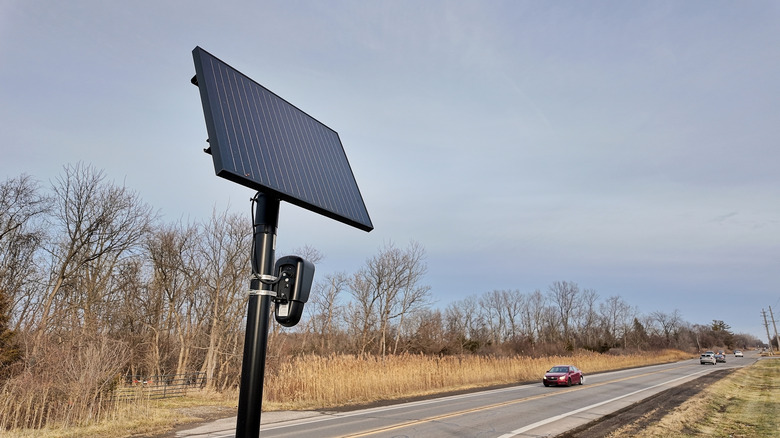
A new layer inside the MapQuest mobile application now plots the physical locations of thousands of outdoor surveillance cameras and automated license plate readers across the United States, giving drivers and residents a direct view of roadside monitoring infrastructure that typically operates without public-facing maps.
The feature aggregates known positions of hardware from more than a dozen manufacturers and data-processing firms. Users can toggle the overlay alongside existing traffic and incident views to see where devices from Flock Safety, Motorola Solutions’ Vigilant division, Genetec, Axis Communications, Axon, Leonardo’s ELSAG unit, Neology, Rekor, PlateSmart, Ubicquia, and Verkada are installed.
Automated license plate readers have proliferated rapidly over the past five years, driven largely by private companies offering subscription-based camera networks to local law enforcement and homeowners associations. Flock Safety alone has installed tens of thousands of solar-powered ALPRs in residential neighborhoods and along commercial corridors nationwide. Unlike traditional closed-circuit television systems maintained by municipal governments, these newer networks often rely on distributed hardware managed through public-private partnerships, making their exact footprint difficult for citizens to track independently.

Privacy advocates and civil liberties organizations, including the Electronic Frontier Foundation, have long argued that unregulated ALPR deployments effectively create mass tracking databases capable of logging the movements of millions of people who are not suspected of any crime. While police agencies credit the technology with recovering stolen vehicles and locating missing persons, critics point out that many municipalities lack clear retention limits or auditing requirements for the location data collected.
By surfacing this hardware on a mainstream navigation platform, MapQuest shifts the dynamic from institutional control to consumer visibility. Drivers relying on the app for daily commutes can now assess how heavily monitored specific intersections or highways are, while neighborhood groups organizing against proposed camera installations gain a ready-made tool to demonstrate existing coverage density to city councils.
The surveillance mapping tool arrives during an unexpected resurgence for the legacy navigation service. MapQuest, which dominated early web-based directions before losing market share to smartphone-era competitors, recently saw a sharp spike in downloads after it declined to rename Lake Ontario to “Lake America” — a change that briefly appeared on both Google Maps and Apple Maps following a geographic naming dispute. Capitalizing on that influx of users, the company rolled out Android Auto integration and public transit routing, features standard on competing platforms for years but previously absent from its own ecosystem.
MapQuest introduced the surveillance layer with a promotional video set to Rockwell’s 1984 single “Somebody’s Watching Me,” signaling a deliberate pivot toward privacy-conscious branding as it attempts to differentiate itself in a market controlled by larger tech firms.
The surveillance camera and license plate reader layer is currently active within the MapQuest mobile application interface.