

Flood Insurance Collapse Leaves Millions of U.S. Homes Exposed as Premiums Surge and Policies Vanish
Outdated FEMA maps and a 90% surge in premiums have triggered a mass cancellation of policies, exposing millions of homeowners in Appalachia and beyond to financial ruin.
The National Flood Insurance Programcom/southern-california-prepares-for-a-potential-super-el-nino/” class=”auto-internal-link” title=”Southern California Prepares for a Potential Super El Niño”>flood insurance Program is hemorrhaging policyholders at a pace that threatens to destabilize disaster recovery across the United States, leaving millions of homeowners exposed to catastrophic financial ruin just as climate-driven downpours intensify.
Over the past five years, roughly 500,000 federal flood insurance policies have lapsed or been canceled. Only 4.5 million remain active nationwide, covering a mere 2.4% of U.S. properties. Yet 8.4% of all properties sit in zones classified at severe or extreme risk of flooding. That widening chasm between actual danger and financial preparation represents one of the most critical vulnerabilities in American infrastructure resilience.
Standard homeowners insurance does not cover flood damage. For decades, the NFIP served as the sole backstop for millions of families living near rivers, coastlines, and low-lying terrain. Now, the program is buckling under contradictory mandates, outdated cartography, and sticker shock.


The primary driver of the exodus is cost. The typical annual premium has climbed to approximately $1,100, a 90% increase over five years. This surge followed the full implementation of Risk Rating 2.0, a pricing overhaul designed to align premiums with individual property risk rather than broad geographic zones. While actuarially sound, the modernization shattered decades of artificially suppressed rates, particularly along the Gulf Coast. In Lake Charles, Louisiana, some residents watched their annual bills jump from $900 to $4,000, prompting widespread cancellations.
Sen. Bill Cassidy, R-La., has criticized both the Biden administration’s rollout and the Trump White House’s defense of the rating system, arguing it pushed coverage out of reach for working-class families without addressing affordability. A May 2026 review commissioned by the Trump administration echoed those concerns, identifying fundamental flaws in a program burdened by more than $20 billion in debt and paralyzed by dozens of short-term congressional reauthorizations that prevent structural reform.
FEMA, which administers the NFIP, maintains that the agency cannot solve the affordability crisis alone. The agency has called for stronger local building codes, smarter zoning laws, and greater competition from private insurers rather than shifting all financial liability onto the federal balance sheet.
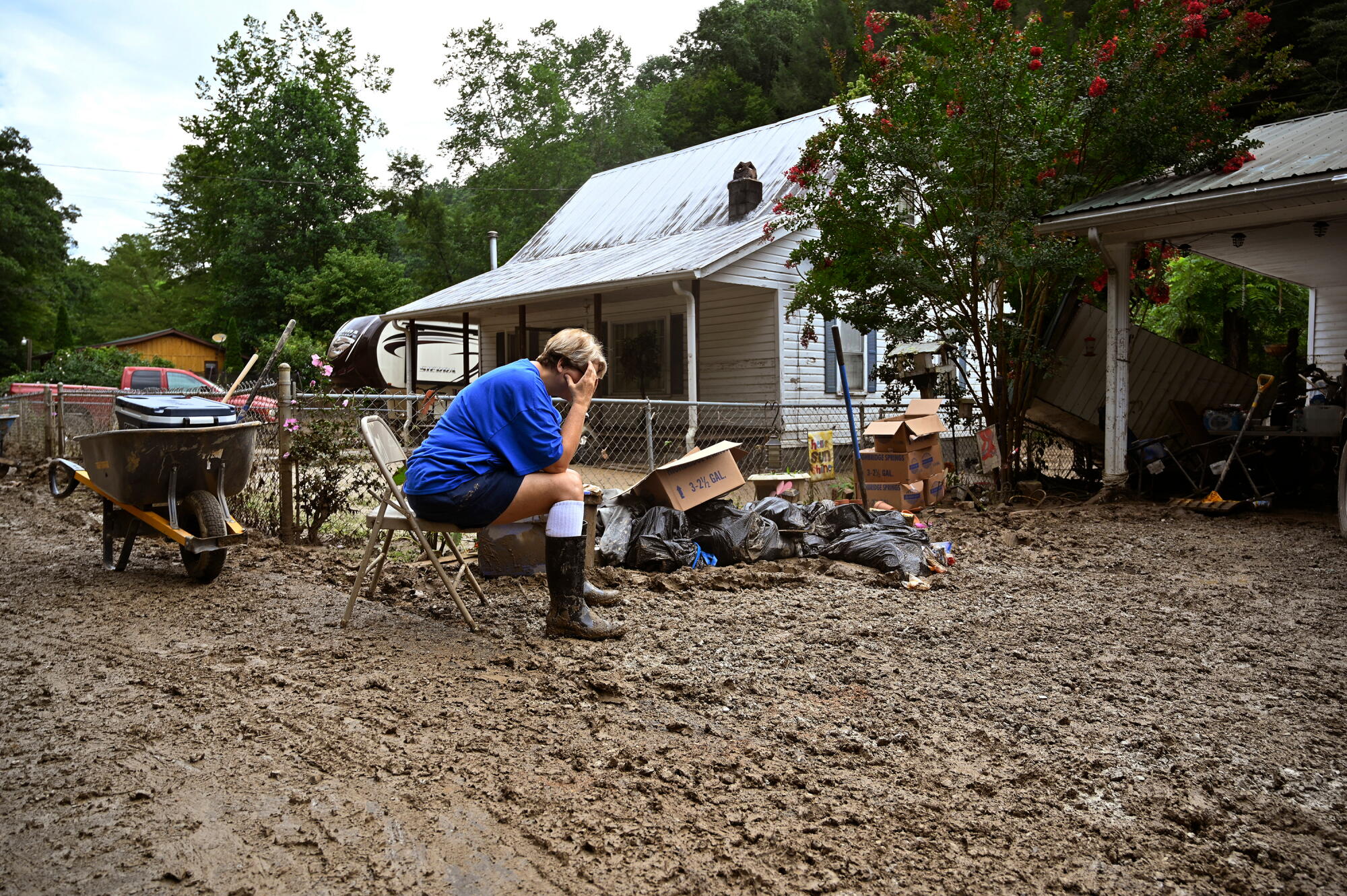
Nowhere is the failure of the current system more visible than in eastern Kentucky, where topography and poverty intersect with systemic mapping blind spots. When torrential rains struck the region in July 2022, killing more than 40 people and requiring 600 helicopter rescues, only 2.1% of affected properties carried flood insurance. Today, that figure remains virtually unchanged, despite data from the risk analysis firm First Street showing that 47% of the properties in the disaster zone face severe or extreme flood risk.
The discrepancy stems directly from FEMA’s reliance on outdated flood maps that historically prioritize coastal storm surge and riverine overflow while failing to account for inland flash flooding driven by extreme precipitation. Only 18% of the Kentucky buildings destroyed in 2022 fell within designated high-risk zones, meaning the vast majority of owners were never legally required to purchase coverage when securing a federally backed mortgage.
Jeremy Porter, chief economist at First Street, an MSCI subsidiary, noted that the largest insurance gaps exist precisely where heavy precipitation flooding occurs far from major water bodies. Appalachia, the inland Midwest, and parts of the Northeast are experiencing the brunt of climate change through sudden, overwhelming rainfall rather than rising sea levels.
By contrast, coastal markets like Charleston, South Carolina, demonstrate how the system functions when mapped correctly. High-risk zones blanket the area, buyers expect flood insurance as a standard closing cost, and higher local incomes absorb the premiums.
In eastern Kentucky, where many residents earn less than $30,000 annually, the absence of insurance transforms a natural disaster into permanent displacement. Following the 2022 floods, FEMA distributed nearly $90 million in direct assistance — roughly one-fifth of the lowest estimates for total rebuilding costs. Federal aid caps housing assistance and other needs at approximately $40,000 each, and few applicants receive the maximum. Crucially, FEMA will deny future aid to uninsured properties located in designated flood zones if they are hit again, a devastating rule for a region plagued by repeat disasters.
The human toll of this coverage gap is accelerating a quiet depopulation of vulnerable Appalachian communities. Eric Dixon, a senior researcher at the Ohio River Valley Institute, documented a clear trend of survivors abandoning damaged homes because they could neither afford repairs nor secure financing. Many relocated to neighboring counties or left the region entirely.
For those who stayed, recovery has been measured in years. Ronald Conley, whose elevated double-wide trailer in Kentucky filled with thick clay mud during the 2022 floods, relied on church donations and a FEMA-provided temporary unit. He moved back into his home only this month. Without insurance, he estimates the rebuilding process took exponentially longer than it would have otherwise.
Others faced outright deception regarding their risk. Jennifer Campbell, whose Troubleside Creek-area home was destroyed after the creek overflowed, said she had previously asked her insurer about flood coverage and was incorrectly told her risk was too low to qualify. The damage cost her $100,000, forcing her to take out loans alongside limited FEMA aid. When floodwaters nearly reached her rebuilt house again in 2025, blocking the access road, she enrolled in a voluntary government buyout program designed to permanently remove structures from flood-prone land.
Bryant Matthews, a Letcher County resident who did carry a policy, illustrates the stark divide. After evacuating his family during the 2022 deluge, his flood insurance paid off the remainder of his mortgage. The payout allowed his family to relocate debt-free to nearby Hazard, closer to work and schools.
FEMA is currently developing updated mapping models intended to capture nuanced inland risks and accurately mandate coverage, though no public timeline exists for their deployment. Until those maps are finalized and Congress resolves the NFIP’s conflicting directives to be simultaneously affordable, financially solvent, universally available, and strictly risk-based, the gap between who needs flood insurance and who can afford it will continue to widen.