

Magnitude 3.8 Earthquake Strikes Near Piru in Ventura County, Felt Across Southern California
Tremors from the Tuesday night quake reached Palmdale, Santa Barbara, and Inglewood as seismologists map the intensity across Ventura and Los Angeles counties.
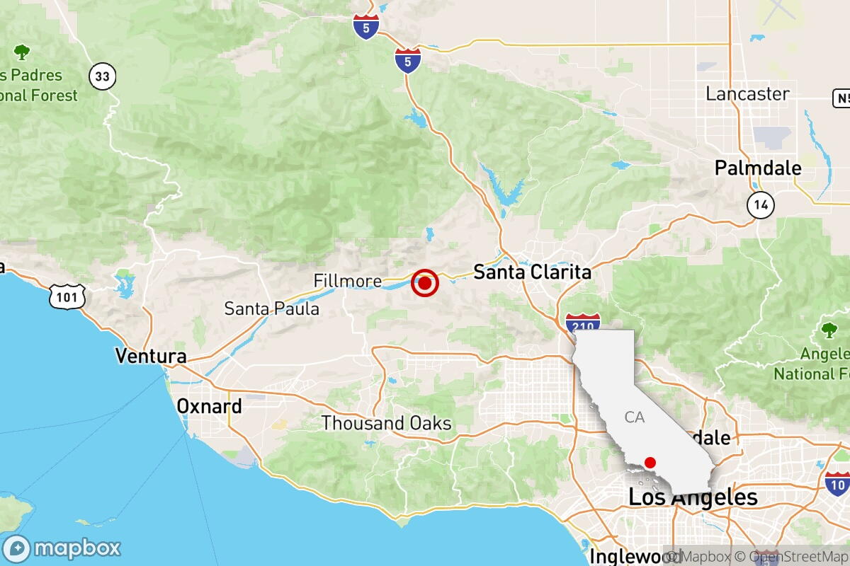
A magnitude 3.8 earthquake rattled eastern Ventura County at 8 p.m. Tuesday, sending tremors across a broad swath of Southern California from Santa Barbara to Inglewood.
The U.S. Geological Survey located the epicenter approximately 2½ miles from the unincorporated community of Piru, at a depth of 6.6 miles. That depth places the rupture within the upper crust, typical for seismic activity along the complex network of fault systems that define the Transverse Ranges geologic province stretching east-west through Ventura and Los Angeles counties.
Shaking registered as weak to light on the Modified Mercalli Intensity scale, which measures the observable effects of an earthquake rather than its raw energy release. Residents reported light to moderate shaking near the epicenter, while perceptible tremors extended as far east as Palmdale in the Antelope Valley, roughly 50 miles away.


Piru sits near several active geological structures, including segments associated with the San Cayetano and Oak Ridge fault zones. While a 3.8 magnitude event does not typically produce structural damage, earthquakes of this size serve as routine reminders of the tectonic stress accumulating beneath the region. Southern California experiences thousands of minor earthquakes annually, most too small to be felt without instrumentation.
The temblor’s proximity to populated suburban corridors meant widespread awareness despite its modest size. The USGS placed the epicenter five miles from Simi Valley, seven miles from both Moorpark and Fillmore, and eight miles from Castaic and Stevenson Ranch. These communities sit directly atop or adjacent to alluvial basins that can amplify seismic waves compared to bedrock, occasionally making smaller quakes feel more pronounced to residents.
Unlike larger events that trigger automatic ShakeAlert notifications to mobile devices across California, earthquakes below magnitude 4.0 generally do not meet the threshold for public wireless emergency alerts unless they occur at unusually shallow depths directly beneath dense urban centers.
The USGS continues to collect Did You Feel It? reports from residents across Ventura and Los Angeles counties to map the precise extent and intensity of the shaking. Seismologists monitor these crowdsourced data points alongside instrumental readings to refine their understanding of how local soil conditions influence ground motion during regional earthquakes.